Gulf Of Mexico: Who Owns It, What Countries Surround It And More


Gallery
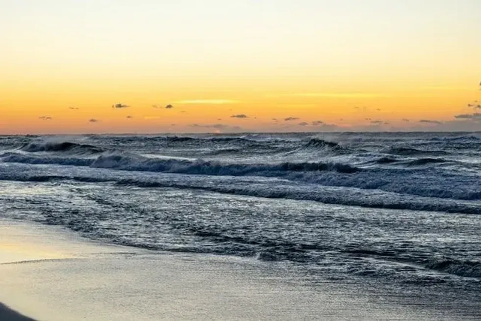
The Gulf of Mexico is a waterway that connects the ocean to the mainland.
Plate tectonics cause gulfs to form, which are typically more prominent and more deeply curved than bays. As a result, they are frequently connected to the ocean via narrow waterways; however, this is not always possible in all regions.
The Mexico Gulf, with a surface size of 582102.7 sq mi (1,507,639 sq km), is the world's most enormous gulf and a peripheral ocean of the Atlantic Ocean.
For more than 35 years, conservation has been a focus of the Gulf States, safeguarding important landscapes via land acquisition, innovating on-the-ground as well as in-the-water recovery initiatives, and pushing for policies that will result in large-scale preservation for each of the Gulf States.
The Gulf of Mexico region's weather ranges between tropical to subtropical. The Gulf Stream is formed when water from the Caribbean Sea reaches the Gulf of Mexico through the Yucatán Channel and loops in a clockwise flow before departing the gulf from the Florida Straits.
The Gulf Stream, which flows from Mexico towards the northern Atlantic Ocean, is among the most solid and hot ocean currents. Some sections of the loop current split away, generating gyres or eddies that disrupt regional patterns.
Do not forget to check out other fun articles about the Gulf of California and the Gulf of Maine.
Physiography And Geology
It is the world's most immense gulf and the 10th largest water source, with a total area of 600,000 sq mi (1553992.87 km). It was formed about 300 million years ago. The Gulf of Mexico, a vast oval-shaped maritime basin between the Yucatan peninsulas and Florida, is a beautiful destination to visit, live, and work in.
The white sand beaches of the Florida and Alabama gulf coast are, without a doubt, some of the most magnificent on the globe. Alabama has four boundaries, each separating it from another state in the United States.
The Gulf of Mexico is bordered on the northeast, north, and northwest by the US states of Louisiana, Mississippi, Alabama, Texas, and Florida; on the southwest and south with the Mexican states of Campeche, Tabasco, Quintana Roo, Veracruz, Tamaulipas, and Yucatan; and on the southeast by the island of Cuba.
In addition, the Yucatán Channel (between Cuba and Mexico) connects the Gulf of Mexico to the Caribbean Sea. As a result, the gulf is among the most densely populated ocean shipping basins in the world.
Along the coastal continental shelf zones, the Gulf of Mexico is relatively shallow, with a depth of approximately 5 ft (1.5 m). The Sigsbee Deep (Mexico Basin), located on the southwestern coast of the gulf, is the gulf's lowest location, with an average depth of over 14 ft (4.2 m).
About 660 quadrillion gal (approximately 2500 quadrillion l) of freshwater are estimated to be in the Mexico Gulf. Padre Island, the most significant barrier island in the world, is placed in the Gulf of Mexico off the southeastern coast in Texas.
These islands, built between 5,000-8,000 years ago, are the remnants of multiple sets of barriers that have occurred along the northwest Gulf Coast over the last centuries, formed and destroyed by changing sea levels and the resulting coastline alteration.
Gulf Of Mexico Research Initiative
The Gulf of Mexico Research Initiative's (GoMRI) aim is to increase society's ability to comprehend and mitigate the effects of petroleum contamination and marine environment stresses, focusing on Gulf of Mexico environments.
Furthermore, the knowledge gained will be used to solve and strengthen the long-term health and climate of the Gulf of Mexico. Offshore assets in federal waters along Alabama, Texas, Mississippi, Louisiana, and Florida are managed by the GOMR.
The Gulf of Mexico Research Initiative is an excellent location for studying gas hydrates. Seismic and logging information, geology analyses, block leasing data, and environmental control are archived by the gas and oil sector in the northern gulf. In addition, at ocean depths that sustain gas hydrates, there is the world's most extensive offshore gas and oil production system.

Fishery Management Areas
The gulf's biota contains a variety of non-chemosynthetic and chemosynthetic creatures, ranging from microbes, such as benthos as well as meiofauna, to macroorganisms, such as sea pens crinoids, crabs, and other marine wildlife.
Seagrasses, marine algae, mangroves, and marsh grasses are among the aquatic vegetation of the Gulf of Mexico. Many fishes, bivalves, planktons, shrimps, manatees, and other marine species find refuge in these plants.
In addition, the colder, nutrient-rich water in deep sections of the gulf is raised to the top through the mechanism of upwelling. As a result, plankton growth is stimulated, attracting many shrimp, tiny fish, and squids.
At one point, an oil slick spread across hundreds of square miles of the ocean's surface, posing a significant threat to marine life and neighboring coastal wetlands, as well as shrimpers and fishers and with the resources of the Gulf Coast.
The 'Flower Garden Banks' are a group of vividly colored coral reefs situated about 115 mi (185 km) southeast of Galveston in the northwestern region of the Gulf of Mexico.
In 1992, the West Flower Garden Bank and the East Flower Garden Bank were declared marine reserves.
Restoring Healthy Shorelines
The gulf's mainland coastline, which stretches more than 4,000 mi (6437.37 km) from the Florida Keys through Cabo Catoche, the Yucatán Peninsula's westernmost extremity, is formed by the United States and Mexico.
The Bay of Campeche is an isthmian embayment that stretches from the western tip of Campeche Bank to the coastal regions immediately east of Veracruz's seaport. From Veracruz to the south, as well as the Rio Grande towards the north, is the western Gulf of Mexico.
C&C Marine archaeologists Daniel J Warren and Robert A Church conducted an archaeological investigation of the seafloor before installing a natural gas pipeline.
The Gulf of Mexico was the scene of a massive oil spill on April 22, 2010, when the Deepwater Horizon, an oil drilling station, exploded and sunk in the gulf roughly 50 mi (80.4 km) from Louisiana.
There were 11 people killed in the accident, and the platform's 18,000 ft (5486.4 m) well spewed 5,000 barrels of oil per day into the Gulf of Mexico.
Cleanup personnel tried to burn the oil off the sea's surface, collect and transport the oil, and keep it from reaching the coast.
It makes ecological and economic sense to restore damaged coastlines to lessen community risk. The Conservancy collaborates with state, federal, and municipal governments to show how shoreline restoration may minimize storm and flood hazards while boosting fish and wildlife ecology and recreational possibilities.
The Conservancy attempts to reinforce shorelines and shows that rehabilitation is a cost-effective strategy to reduce storm susceptibility while also re-creating crucial habitats for Gulf inhabitants and migratory species by planning and supporting projects.
Protecting The Gulf's Waters
The sea surface temperatures of the Gulf of Mexico in February ranged from 64.4 F (18 C) in the northern part of the gulf to around 75.2 F (24 C) off the Yucatán coast.
The ocean temperature reaches about 89.6 F (32 C) during the summer months—hot ocean temperatures of the Gulf of Mexico fuel severe Atlantic storms, which cause widespread devastation. A Louisiana scientist has predicted a 12 ft (3.65 m) rise in sea level by 2040 based on an Environmental Protection Agency assessment.
The hurricane season technically spans from June 1 till November 30. During this time, storms can form anywhere in the Gulf of Mexico due to favorable meteorological and oceanic conditions.
One in Galveston in 1900 and one in and near New Orleans in 2005 were particularly destructive storms. Mangrove forests, oyster reefs, and wetlands, among the gulf's most significant natural coastal characteristics, all require continuous flows of pure freshwater to survive.
Because 60% of the water in the United States washes into the Gulf of Mexico, the sustainability of forests, wetlands, and prairies further upstream is crucial.
The Gulf of Mexico program of the Conservancy is working in tandem with similar projects in the Bottom and Top Mississippi regions to assist ranchers, farmers, and forest owners in restoring natural areas and reducing the flow of nutrients into streams and rivers.
These bodies of water become 'dead zones' over time. For example, the Mississippi River is the biggest river that flows into the Gulf of Mexico, so it carries many harmful toxins. As a result, dead zones have formed in the Gulf region.
Here at Kidadl, we have carefully created lots of interesting family-friendly facts for everyone to enjoy! If you liked our Gulf of Mexico facts, then why not take a look at Banda sea facts or Gulf of Aden facts?


We Want Your Photos!
More for You


See All
Bachelor of Arts specializing in English Language, Master of Philosophy
Devangana RathoreBachelor of Arts specializing in English Language, Master of Philosophy
Devangana is a highly accomplished content writer and a deep thinker with a Master's degree in Philosophy from Trinity College, Dublin. With a wealth of experience in copywriting, she has worked with The Career Coach in Dublin and is constantly looking to enhance her skills through online courses from some of the world's leading universities. Devangana has a strong background in computer science and is also an accomplished editor and social media manager. Her leadership skills were honed during her time as the literacy society president and student president at the University of Delhi.
Postgraduate Diploma in Management
Sakshi RaturiPostgraduate Diploma in Management
Sakshi has experience in marketing strategy, social media planning, and recruiting industry experts for capstone projects, she has displayed a commitment to enhancing their skills and knowledge. She has won multiple awards, including a Certificate of Appreciation for Creative Writing and a Certificate of Merit for Immaculate Turut, and is always seeking new opportunities to grow and develop.
Disclaimer
1) Kidadl is independent and to make our service free to you the reader we are supported by advertising. We hope you love our recommendations for products and services! What we suggest is selected independently by the Kidadl team. If you purchase using the Buy Now button we may earn a small commission. This does not influence our choices. Prices are correct and items are available at the time the article was published but we cannot guarantee that on the time of reading. Please note that Kidadl is a participant in the Amazon Services LLC Associates Program, an affiliate advertising program designed to provide a means for sites to earn advertising fees by advertising and linking to Amazon. We also link to other websites, but are not responsible for their content.
2) At Kidadl, we strive to recommend the very best activities and events. We will always aim to give you accurate information at the date of publication - however, information does change, so it’s important you do your own research, double-check and make the decision that is right for your family. We recognise that not all activities and ideas are appropriate for all children and families or in all circumstances. Our recommended activities are based on age but these are a guide. We recommend that these ideas are used as inspiration, that ideas are undertaken with appropriate adult supervision, and that each adult uses their own discretion and knowledge of their children to consider the safety and suitability. Kidadl cannot accept liability for the execution of these ideas, and parental supervision is advised at all times, as safety is paramount. Anyone using the information provided by Kidadl does so at their own risk and we can not accept liability if things go wrong.
3) Because we are an educational resource, we have quotes and facts about a range of historical and modern figures. We do not endorse the actions of or rhetoric of all the people included in these collections, but we think they are important for growing minds to learn about under the guidance of parents or guardians.