42 Cape Horn Facts: A Rocky Headland On Hornos Island!


Gallery
Cape Horn is an enchantingly beautiful and thrilling place to visit, located at the southernmost point of South America.
The Cape Horn region was among the preferred sailing routes, and the Dutch sailors discovered it in 1616. Clipper ships sailed round Cape Horn laden with cargo.
But soon, sea fares began to call this place a 'mariner's nightmare'. Several factors make this route one of the most hazardous and treacherous sea routes. Strong winds, frigid weather conditions, and extreme wave patterns result in intense rolling and pitching, thus making the voyage a scary experience.
This portion of the sea has an unusual seabed where the seafloor rises drastically from 330-13,200 ft (100.6-4023.4 m). This happens suddenly over a short distance.
Such a drastic rise in the seafloor results in friction from the waves, thus causing an uproar from the waves. Also, the Atlantic, Pacific, and Southern oceans meet at this juncture, making it a turbulent one!
The sea around this island has claimed the lives of many brave sailors who went round the world sailing. Some records say that the ocean around this region has caused over 800 shipwrecks and has claimed the lives of over 10,000 seamen.
The waters around the Cape have taken more than their fair share of sailors: it is estimated that at least 800 ships were shipwrecked between the 16th and 20th centuries, resulting in the deaths of over 10,000 sailors.
An example of how dangerous this route is can be seen when explorers Miles and Beryl Smeeton tried to round the Horn on their yacht Tzu Hang. They were hit by a strong wave with little or no warning.
Though they survived, they were unable to complete their journey. In 1934, Norwegian Al Hansen, in his boat Mary Jane, was the first to round the Horn, traveling the wrong way, from east to west.
Cape Horn has been mentioned in many sailing books and sea shanties. In sailing culture, Cape Horn has been depicted as a sea icon.
Once you have finished reading this article, Cape Horn facts, why not discover more about the Arctic Ocean Islands and the Jeju Island South Korea?
Geography Of Cape Horn
Read on to learn more about Cape Horn and the area nearby.
Cape Horn was first identified and rounded in 1916 by the Dutch navigators William Schouten and Jacob Le Maire. It was originally named 'Kaap Hoorn' after the Dutch city of Hoorn, where Schouten was born.
Did you know that the famous explorer Sir Francis Drake, when circumnavigating the globe in 1578, was blown into this area during his voyage north? At that time, this region was thought to be another continent.
Cape Horn is located on the island of Isla Hornos in the Hermite group of islands, located at the southern end of the Tierra del Fuego archipelago in southern Chile. Just past Cape Deceit lies the Horn.
It is situated at the point where the Atlantic and Pacific oceans meet. Cape Horn Island is located at the southernmost point of South America. The Drake Passage connects South America and Antarctica, and Cape Horn is its northernmost point.
For many years, trade and passenger ships sailing from Australia to Europe have sailed around Cape Horn. Did you know that Cape Horn is not an actual cape as it is not on the American mainland but a small island?
The nearest weather station is located on the nearby Diego Ramírez islands. Gale force winds occur that result in a head sea, making the journey around the Horn quite dangerous for sailors venturing into this area
An opposing east wind through the Drake Passage can cause build-up or increase the size of the waves, making this area even more deadly. It is estimated that between the 16th and 20th centuries, there were 800 shipwrecks in this area, which caused the deaths of about 10,000 sailors.
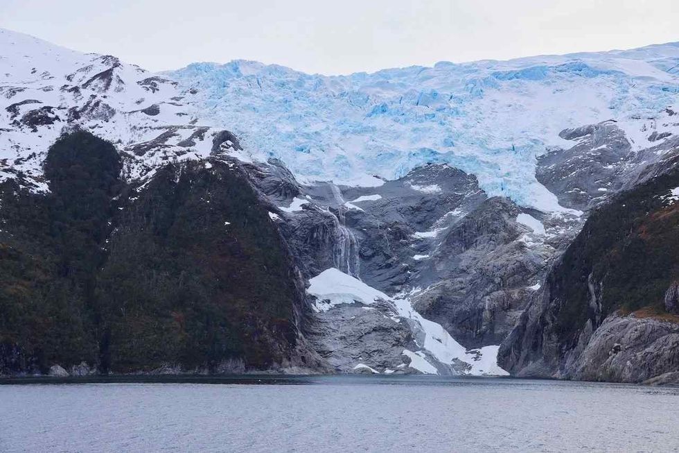
Ice is also another reason that makes this area so dangerous for ships. Even though the ice limit dips south, there are many icebergs in the region. A significant problem that residents face in this area is the depletion of the ozone layer as it is close to the Antarctic ozone hole.
Even with all these hazards and the opening of the Suez and Panama Canals, the Horn is still considered the fastest sailing route worldwide. Navigating round the Horn has been compared to climbing Mount Everest and, hence many sailors with modern sailing boats still try to achieve this nearly impossible feat

Ecology Of Cape Horn
With 8,700 mi (14,000 km) of water, this southern point in the Pacific Ocean has a diverse ecology.
Many birds and marine animals live and thrive in and around Cape Horn and its ocean. These include sea lions, humpback whales, albatross, penguins, and more. This region also has the southernmost kelp forest in the world.
The Cape is also the southern limit of the Magellanic penguin. Due to the strong winds, there are no trees on Cape Horn. However, it is quite green and lush due to the high rainfall and snowfall.
An expedition team discovered the world's southernmost tree, a Magellan beech on the Cape, in 2019. The Diego Ramirez islands are nearby and are home to many different birds, including the rockhopper penguin and the black-browed albatross.
The Horn is where the Atlantic and Pacific oceans meet, but did you know that they do not mix, although they are both water bodies? This is because of the difference in water densities and currents. It is this difference that also makes the seas around the Horn so rough and dangerous.
Climate Of Cape Horn
If you are planning a trip to the Horn, you should know about the climate.
Due to the southern latitude, the climate of Cape Horn is cool. It receives about 278 days of rainfall, including 70 days of snow.
Wind speeds here could be up to 18.6 mph (30 kph), with squalls having a speed of 62.1 mph (100 kph). During the summer, about 5% of the time, the wind around Cape Horn is gale force, and the visibility is good generally.
This region experiences white nights during the winter solstice when the sun is visible in the sky at the local midnight.
Political Scenario In Cape Horn
The political scenario of Cape Horn mimics its infamous, treacherous black cliffs and unruly waves. It is layered with terrorism, kidnapping for ransom, social crisis, intercommunal violence, and persistent attacks by extremists. Along with these, the corruption rooted in its politics makes this place very volatile.
The inflated link between terrorism, intercommunal hate and violence, and organized crime cannot be stressed enough. Despite constant efforts by the UN, this volatility continues to persist. Brutal extremist attacks on security forces and civilians undermine peace and security. Further, the forced recruitment of children into fighting is shaking the future of Horn City.
Tourism In Cape Horn
Check out the information below to plan your adventurous and memorable trip to Cape Horn.
Cape Horn is best visited during the summer, when cruise ships can sail there. The warmer conditions also make the trip worthwhile. You can visit the island on an expedition cruise ship. There are many that operate in the area.
If you're worried about the Drake Passage, you can take a flight over Punta Arena Island. This way, you would be able to enjoy the exquisite scenic beauty of the region.
Wulia Bay is a historical site as it is considered to be the largest settlement of the indigenous Yamana people. The museum there showcases the history of this almost extinct population.
There are two lighthouses at Cape Horn. The largest and most accessible one is at the Chilean Naval Station.
The second lighthouse is located a mile away from the naval lighthouse on the actual 'horn'. This lighthouse is not accessible, but cruise ships sail around Cape Horn so that visitors can view it. The height of this lighthouse is 13 ft (4 m).
Did you know you can get your passport stamped by the family that operates the Chilean lighthouse? The stamp is unusual and makes a great souvenir. Another amazing fact is that the lighthouse keeper and his family are the only residents on Cape Horn.
Stella Maris Chapel is another place to visit in Cape Horn. This small chapel is near the main lighthouse. The doors of this one-room chapel are about 12 ft (3.7 m) long. Here you can pray for the many sailors who lost their lives in the waters around the Horn.
If you're visiting Cape Horn, another place of interest is the Cape Horn Memorial that can be accessed, which is about 1000 ft (304.8 m). This walkway on Hornos Island was built in 1992.
This memorial was built to honor the thousands of mariners who lost their lives in the waters here. Plan to visit on a mild day as the scenery is worth seeing.
The Cape Horn Monument features a flying albatross, a commonly seen bird in the Southern Ocean. It is the symbol of the Cape Horn Captains' Brotherhood and was designed by a Chilean artist.
The height of the Cape Horn Monument is about 22 ft (6.7 m), and it is constructed of steel plates.
Did you know that it can withstand winds of 200 mph (321.9 kph)? Another interesting fact is that the Chilean Marine Corps transported 120 tons (108.9 m tons) of materials in two barges to build this monument.
A visit to Hornos Island is incomplete without seeing the 'actual' horn. The water surrounding this rocky, narrow strip of land makes it difficult to access by foot or boat. The cruise captain would point it out to you.
You can also visit the False Cape Horn, known as the 'Falso Cabo de Hornos'. This is a headland at the southern tip of Hoste Island.
Among the well-known clipper routes, traditional sailing ships and cargo ships sailed around the Horn carrying wool, grain, and gold from Australia back to Europe. However, the opening of the Panama Canal in 1914 and the transcontinental railroads of Central America replaced the need to sail around the Horn.
The last commercial sailing ship to round the Horn was the Flying-P liner, Pamir, in 1949.
Here at Kidadl, we have carefully created many interesting family-friendly facts for everyone to enjoy! If you liked our suggestions for Cape Horn facts, why not look at Bahrain as an island or Battle of Long Island facts.


We Want Your Photos!
More for You


See All
Bachelor of Science specializing in Human Anatomy
Joan AgieBachelor of Science specializing in Human Anatomy
With 3+ years of research and content writing experience across several niches, especially on education, technology, and business topics. Joan holds a Bachelor’s degree in Human Anatomy from the Federal University of Technology, Akure, Nigeria, and has worked as a researcher and writer for organizations across Nigeria, the US, the UK, and Germany. Joan enjoys meditation, watching movies, and learning new languages in her free time.
Disclaimer
1) Kidadl is independent and to make our service free to you the reader we are supported by advertising. We hope you love our recommendations for products and services! What we suggest is selected independently by the Kidadl team. If you purchase using the Buy Now button we may earn a small commission. This does not influence our choices. Prices are correct and items are available at the time the article was published but we cannot guarantee that on the time of reading. Please note that Kidadl is a participant in the Amazon Services LLC Associates Program, an affiliate advertising program designed to provide a means for sites to earn advertising fees by advertising and linking to Amazon. We also link to other websites, but are not responsible for their content.
2) At Kidadl, we strive to recommend the very best activities and events. We will always aim to give you accurate information at the date of publication - however, information does change, so it’s important you do your own research, double-check and make the decision that is right for your family. We recognise that not all activities and ideas are appropriate for all children and families or in all circumstances. Our recommended activities are based on age but these are a guide. We recommend that these ideas are used as inspiration, that ideas are undertaken with appropriate adult supervision, and that each adult uses their own discretion and knowledge of their children to consider the safety and suitability. Kidadl cannot accept liability for the execution of these ideas, and parental supervision is advised at all times, as safety is paramount. Anyone using the information provided by Kidadl does so at their own risk and we can not accept liability if things go wrong.
3) Because we are an educational resource, we have quotes and facts about a range of historical and modern figures. We do not endorse the actions of or rhetoric of all the people included in these collections, but we think they are important for growing minds to learn about under the guidance of parents or guardians.