22 Hurricane Isabel Facts: Aftermaths, Precautions & Much More!


Gallery
Hurricane Isabel is the deadliest, strongest, and costliest Atlantic hurricane since Mitch.
Hurricane Isabel is also considered the most intense and major hurricane of the Atlantic hurricane season in the year 2003. Hurricane Isabel was undoubtedly the strongest hurricane-both in terms of central pressure and wind speed-in the Atlantic open waters until two other hurricanes, Irma and Dorian, surpassed it in 2017 and 2019.
It was the season's ninth named storm, the second major, and the fifth hurricane. Isabel moved with peak winds of 167 mph (270 kph).
Flooding from Hurricane Isabel, as well as a storm surge, caused significant damage in the eastern United States. The storm surge opened a new breach in Hatteras Island, located southwest of Cape Hatteras, to create an inlet 2,000 ft (609.6 m) wide, unofficially referred to as the Isabel Inlet.
This aside, several thousand houses were damaged along the Outer Banks. Virginia reported the most deaths caused by this fifth hurricane. While millions lost power, local flooding caused severe damage in Virginia.
After you've finished reading about Hurricane Isabel facts, click here to learn more about Hurricane Hugo facts and hurricane categories.
Preparedness For Hurricane Isabel
On September 16, two days before the landfall, when the Isabel hurricane center was 600 mi (965 km) away, the National Hurricane Center raised a hurricane watch for the North Carolina coast from Little River in South Carolina to Virginia, including the lowest parts of Chesapeake Bay and Chincoteague.
A tropical storm watch was also issued from south of Little River to the South Santee River mouth. Later, as the hurricane steadily strengthened, tropical storm warnings and hurricane warnings were issued for many other places, mainly the East Coast areas of the US.
Mandatory evacuations were declared for 24 counties in Virginia, North Carolina, and Maryland. According to an official survey, over 12,000 residents were escorted to emergency shelters.
Also, 19 airports along the US East Coast were shut, over 1,500 flights were canceled, the Washington Metrobus and Metro system closed, and train services towards the south of the US capital were also canceled.
This aside, 40 ships, submarines, and several aircraft were removed from the naval sites near Virginia. Schools and colleges also remained shut down along the course of Hurricane Isabel.
A contingency plan was also kept ready for implementation, but it was not put to use.
The Pattern Of Hurricane Isabel
The pattern of the hurricane named Isabel was pretty interesting.
On September 1, a tropical wave moved off Africa’s western coast and an area of low pressure accompanied the wave as it moved westward.
On September 6, Hurricane Isabel formed from a tropical wave near the Cape Verde Islands in the tropical Atlantic Ocean. Located within an area of warm waters and light wind shear, the Isabel hurricane gradually developed into curved bands.
It then moved west-northwest and developed into a Category 1 hurricane the next day. It then steadily strengthened, moving through Categories 2 and 3, before entering Category 4 by September 8.
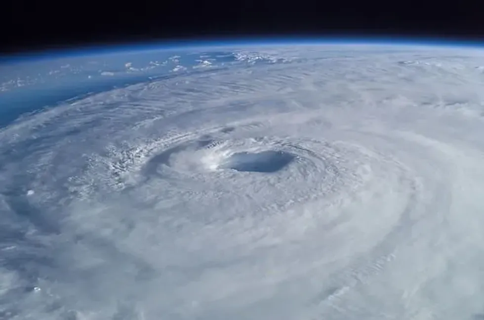
On September 11, it developed into a rare Category 5 hurricane, moving with winds of 165 mph (270 kph). Over the next few days, the intensity of this major hurricane fluctuated as it continued moving north-northwest.
On September 12-when it was at its peak intensity-the lowest pressure of Hurricane Isabel at the northeast of the Leeward Islands was recorded.
Finally, the ninth named storm made its landfall as a Category 2 storm on the North Carolina outer banks between Cape Hatteras and Cape Lookout on September 18 (afternoon). Fortunately enough, Hurricane Isabel encountered vertical light wind shear that made it lose its intensity before landfall.
At that time, its peak winds were close to 105 mph (169 kph). It quickly weakened, even more, the next day and became an extratropical cyclone over western Pennsylvania. On September 20, another system absorbed the extratropical remnants of Hurricane Isabel over eastern Canada.
What made the forecast easy for Isabel Hurricane was its relatively predictable steering pattern. The authorities were able to anticipate that the ninth named storm of the 2003 Atlantic hurricane season would move westward and continue that course for several days.
Besides, these types of tropical cyclones are usually easier to forecast. Only 13 hours after Isabel formed, the National Hurricane Centre started issuing advisories.

The Outcome Of Hurricane Isabel
This major hurricane caused moderate to extensive damage along the Atlantic coastline. Strong winds assisted by Isabel dominated areas from North Carolina to New England as well as westward to West Virginia.
Isabel washed away several houses as rain fell down several trees; around 6 million lost power. Parts of coastal Virginia were without a power supply for almost a month.
Isabel-occurred wind also inflicted minor damage to the barrier islands. The storm surge peaked at 9 ft (2.7 m) in Richmond, causing the worst flooding in the area since the Chesapeake and Potomac hurricanes in 1933. Through its course, Hurricane Isabel caused damage worth $5.5 billion.
Such was its impact that the Isabel hurricane was considered the first major hurricane to hit the upland South and the mid-Atlantic states since September 1999’s Hurricane Floyd.
More than 60 million people were affected by the sustained winds and the storm extended by this fifth hurricane of the Atlantic hurricane season of 2003.
Loss Of Human Capital
Forming in the tropical Atlantic Ocean, Hurricane Isabel claimed several lives across the US states.
More than 15 deaths were directly related to Hurricane Isabel, while 35 deaths were indirectly related to it. Approximately 70% of the deaths and 65% of the damage took place in North Carolina and Virginia. Apart from this, deaths occurred in New Jersey, Maryland, New York, Rhode Island, Florida, and Pennsylvania.
After a week of Hurricane Isabel passing by, the then-President, George W. Bush, declared disaster areas for 77 independent cities and counties in Virginia, 36 North Carolinian counties, three counties in Delaware, six counties in West Virginia, and the entirety of Maryland.
Within four months, $516 million in disaster assistance was spent, primarily in Virginia and North Carolina. Over $117 million was approved to help residents repair houses and build houses.
Here at Kidadl, we have carefully created lots of interesting family-friendly facts for everyone to enjoy! If you liked our suggestions for Hurricane Isabel facts, then why not take a look at the categories of a hurricane, or do hurricanes have lightning.


We Want Your Photos!
More for You


See All
Master of Computer Science
Abhijeet ModiMaster of Computer Science
An experienced and innovative entrepreneur and creative writer, Abhijeet holds a Bachelor's and Master's degree in Computer Application from Birla Institute of Technology, Jaipur. He co-founded an e-commerce website while developing his skills in content writing, making him an expert in creating blog posts, website content, product descriptions, landing pages, and editing articles. Passionate about pushing his limits, Abhijeet brings both technical expertise and creative flair to his work.
Disclaimer
1) Kidadl is independent and to make our service free to you the reader we are supported by advertising. We hope you love our recommendations for products and services! What we suggest is selected independently by the Kidadl team. If you purchase using the Buy Now button we may earn a small commission. This does not influence our choices. Prices are correct and items are available at the time the article was published but we cannot guarantee that on the time of reading. Please note that Kidadl is a participant in the Amazon Services LLC Associates Program, an affiliate advertising program designed to provide a means for sites to earn advertising fees by advertising and linking to Amazon. We also link to other websites, but are not responsible for their content.
2) At Kidadl, we strive to recommend the very best activities and events. We will always aim to give you accurate information at the date of publication - however, information does change, so it’s important you do your own research, double-check and make the decision that is right for your family. We recognise that not all activities and ideas are appropriate for all children and families or in all circumstances. Our recommended activities are based on age but these are a guide. We recommend that these ideas are used as inspiration, that ideas are undertaken with appropriate adult supervision, and that each adult uses their own discretion and knowledge of their children to consider the safety and suitability. Kidadl cannot accept liability for the execution of these ideas, and parental supervision is advised at all times, as safety is paramount. Anyone using the information provided by Kidadl does so at their own risk and we can not accept liability if things go wrong.
3) Because we are an educational resource, we have quotes and facts about a range of historical and modern figures. We do not endorse the actions of or rhetoric of all the people included in these collections, but we think they are important for growing minds to learn about under the guidance of parents or guardians.