Types Of Terrain That All Trekkers Need To Know About


Gallery
The term terrain originates from 'terra' which means 'Earth'.
It is a term referring to the Earth's surface in both horizontal and vertical forms. The gradient, altitude, and angle of the ground are all used to characterize the topography of the land.
The movement and dispersion of water are influenced by the topography of the land.
Furthermore, the terrain types of land impact the weather patterns and temperature of the area in large land tracts. Bathymetry, which assesses the topography of submerged surfaces, is equal to the terrain.
Geographers are known for studying the various distinctive and distinct topographical features found all over the world. 'Hostile terrain' is a term used to describe a location with many hills, wide swaths of sand, or impenetrable jungles.
The assessment of topography is crucial in determining which habitats are most suited for humans and their behaviors. Agriculture, trade, transportation, travel, manufacturing, and a variety of other industries are among them. Terrain can be described by high altitudes, slopes, soil, and other geographical factors.
Continue reading to learn some more interesting facts about the types of terrains. After reading these facts about terrains, you may also look at other fun fact articles like jungle trees and agricultural facts.
Main Types Of Terrain On Earth
Terrains come in a variety of shapes and sizes. Highland, mountainous, plains, meltwater valleys, and valley terrains are the most prevalent. Open ground terrain, tundras, oases, grasslands, deserts, freshwater swamps, woodlands, marshes, streams, and hills are some other terrain types.
Tundra refers to plain and freezing wastelands, whereas open terrains relate to flat and wide meadows. A desert is a sandy and dry terrain. An oasis is a flatwater body around a desert, while a desert is a devoid and arid ground. Examples of tundra terrains include the alpine tundra, the Arctic tundra, and the Antarctic tundra.
The hill terrain is softly rising, but the mountain landscape is rapidly climbing. Rivers are large bodies of flowing water, whereas a temperate rainforest is a densely forested place.
Finally, marsh terrain is mushy and damp, whereas swampy terrain is muddy and very wet.
A plateau is a flat, elevated area of land that rises dramatically above the surrounding topography. In most cases, this increase happens in at least one direction.
Plateaus are present on all continents and occupy 1/3 of the Earth's surface. Hollowed plateaus and volcano plateaus are the two primary types of plateaus. The creation of a fragmented plateau is caused by the upward motion of the planet's crust.
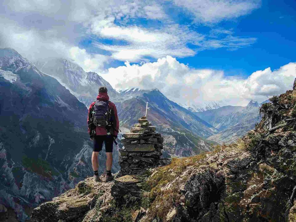
Mountains are massive granite slabs that may be found throughout the world, even below sea level. They usually feature steep sides with sloping land with rugged or curving ridges and a high point called a top or peak.
A mountain is a landform that rises above its surroundings by at least 1,000 ft (304.8 m). The best example of the mountain terrain is the northern Alaska terrain
Box canyons are deep gaps produced over geological time by erosion and the abrasive action of a river. Rivers have a strong proclivity for slicing through underlying minerals, eventually eroding horizontal strata as deposits wash down. Wind erosion and corrosion create slot canyons when the river's water source and mouth are at drastically different heights.
Karst terrain is formed by the disintegration of permeable bare rocks such as limestones, gypsums, and dolomites. Cavities and swales, as well as underground watersheds, are well-known features. Distinguishing karst traits may only be observable at subterranean levels while being completely missing above the surface in regions where disintegrating bedrock is covered or limited by resilient sedimentary layers.
A glacier is a big, dense mass of ice that moves rapidly under pressure. A glacier forms when the accumulation of snow exceeds the rate of water sublimation over a lengthy period, usually decades or centuries. Fjords, cirques, and moraines are the consequence of glaciers damaging rock and debris from their substrate.
A dune is a landform created by sand movement caused by wind or rain. It frequently takes the form of a hill, incline, or pile.
Dunes exist in a range of sizes, but most have a bigger up-flow face on the trailing edge where sand is propelled up the dunes and a lower slide face on the windward side. Between two dunes, dune slacks are downturns or dips.
A plain is a flat land of terrain with only minor elevation changes that is mainly barren of the tree line.
Flatlands in a basin or at the bottom of mountains, coastal regions, mesas, and highlands are all examples of plains. Plains along the shore progressively rise from sea level until they reach higher heights.
The main valley is a long, low area that runs across mountains and hills and typically has a body of water or creek running through it from one end to the other. Rivers eroding the terrain over a lengthy period create the bulk of rift valleys.
Meltwater valleys are U-shaped valleys and are frequent in mountainous areas where glaciation has occurred or is still happening. Other examples of valley terrains include rift valleys, box valleys, hanging valleys, glacial valleys, and tunnel valleys.
A marsh is a type of marshland in which herbaceous plants outnumber woody plants. Wetland habitats near lakes and rivers are common around the edges of these large bodies.
Freshwater marshes or tidal marshes are distinguishable from other wetland types by their absence of temperate forest cover, in contrast to swamps, which have an abundance of tree growth, and mires, which are wetlands with acidic peat deposits.
Buttes are smaller structures than mesas, plateaus, and tablelands, with tapering sidewalls and a low, often flat top. Because of their unique shapes, buttes are commonly regarded as landmarks in both plains and hilly terrains.
The weather conditions of South America differ greatly, from the steamy and moist Amazon River to the arid and desert-like atmosphere of northern Mexico and southern Chile.
The Importance Of The Study Of Terrain
Geomorphology is the research of how terrains are formed. Terrain creation is influenced by three key processes: geological processes, erosional processes, and meteorite strikes.
River developments, volcanic activity, rifting and folds, and tectonic plate movements are all part of the geological process. On the other side, the erosional process involves weathering activities on land. Wind eroding, water deterioration, and landslides are among them.
Meteorite impacts are the third method that terrains are generated. When meteorites hit the ground, they leave behind craters loaded with meteorite ores.
To begin with, the geography of a piece of land determines its appropriateness for human habitation. Ground that is level and plain is usually ideal for human settlement, whereas steep sides are not.
Secondly, knowing how to read terrains is important for agricultural purposes. It gives landowners access to information on water flow, draining features, and watershed borders.
Finally, the topography description enables soil conservation initiatives such as contours plowing. Contour plowing is required to make sloping ground workable.
Terrains are very important for military tactics. They aid armed forces in creating defensive and offensive attack methods when at war. Mountains and woodland locations are ideal for warfare because troops may conceal from their opponents and attack them when they least suspect it.
The weather patterns are the fifth important aspect of terrains. Rainfall and temperature levels are influenced by differences in height and topography.
Finally, geography has an impact on aviation, particularly for aircraft with low-flying routes and airport elevations. Pilots can prevent an accident if they have a good awareness of the terrain.
Navigation In Different Types Of Terrain
There are often many topographical cues to direct your progress when working in large basins amid mountainous regions or on rocky plateau deserts.
Deserts are huge, dry areas that get little or no precipitation throughout the year. The landscape in desert areas ranges from plains to lava fields and salt marshes.
The sand, the hard-baked Earth's surface, rocky surfaces, prickly plant and animal life, and heat of the desert terrain have significantly greater demands when it comes to upkeep than would be expected in high or low temperate climates.
You must use caution while operating in an environment with few visual signals, such as sand or dune deserts, or when sight is limited by a blizzard or darkness. When it comes to the military, successful desert operations need tactical mobility and rapidity.
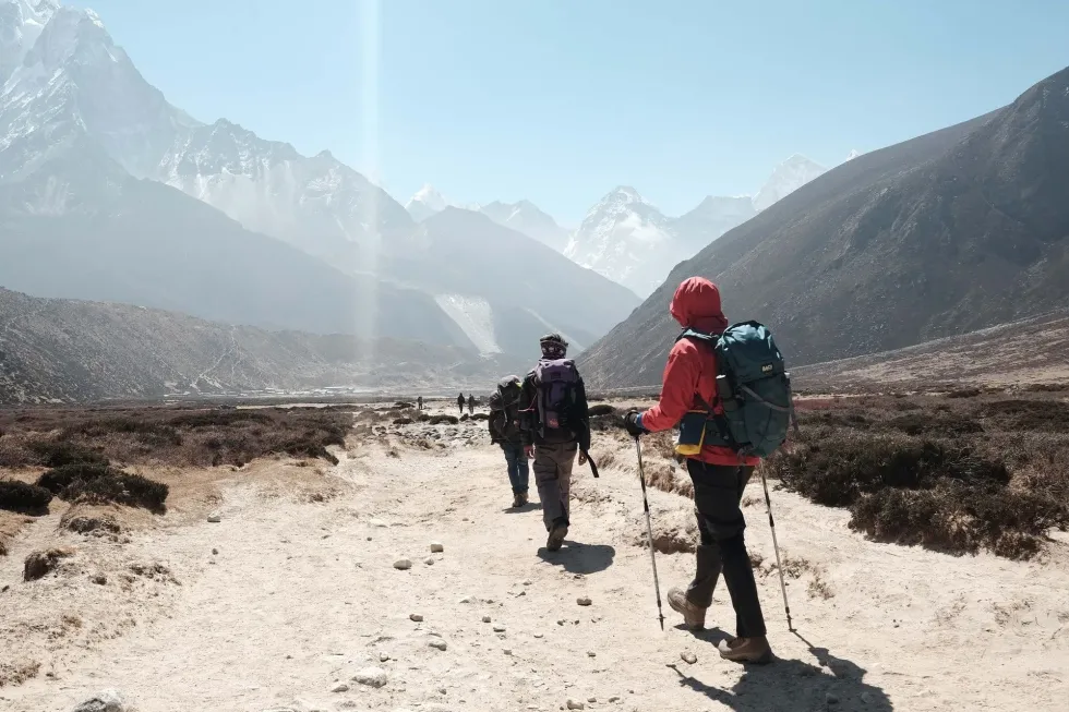
Hills are often seen to be smaller than mountains. Mountains are seldom found alone; instead, they are usually found as extended ranges or circular groupings. Heavy troops must operate via vehicle-negotiable passes and tributary valleys. Established roads and trails provide the most efficient travel options.
Those parts of the Arctic landscape that undergo lengthy periods of low temperatures are known as Arctic terrain. While icy ground and ice might increase trafficability, a substantial snowfall can decrease it.
Under these extremely low temperatures, vehicles and workers require particular equipment and attention. In polar terrain, certain abilities, such as the right use of winter apparel, skis, and snowshoes, may be necessary, although this has no bearing on your navigational techniques.
These vast geographical areas may be found around the equator in the tropics. Rainy, humid places with thick belts of entangled, impenetrable vegetation are known as jungles. Jungles are home to a diverse range of fauna. Because of the dense greenery, it may be more difficult when traversing in these places.
Any stretch of stream with a downward flow can help a lost traveler in the wild make his route back to civilization. Because aerial surveys are difficult in densely temperate forest areas, such as jungles, they are rarely adequately documented.
The capacity to see landscape features, whether close up or far away, is severely limited. In this context, terrain study, the continual use of a compass, and an exact pace count are all necessary for navigation.
Biodiversity In Different Types Of Terrain
The term 'biodiversity' refers to the enormous variety of species on the globe.
Biodiversity refers to all living things, including plants, microbes, animals, and people. There are more than eight million flora and fauna on the globe, according to biologists.
Natural ecosystems provide us with breathable air, drinkable water, food to eat, and materials to produce timber and paper by bringing together live species and the inanimate aspects of their environment, such as rocks and soil.
Mountains are home to half of the world's biodiversity hotspots, and they sustain around a quarter of all terrestrial biological variety. Rare plant and animal species can be found in the mountain range. Gorillas, mountain lions, and astonishingly attractive flora are among the increasingly uncommon wildlife.
Highly sought medicinal herbs are among the most precious resources. This diverse variety is culturally, ecologically, and economically significant. Changing climate, poverty, commercial mining, forestry, and poaching all take a toll on biodiversity in the treeless mountain track.
Plateaus are a globally unique bio-geographic zone with diverse landscapes, high altitudes, highland ecosystems, and vulnerable and endemic species. The presence of huge natural habitat regions is both unique and significant in a region defined by high population densities and the existence of multiple animal species.
The avian fauna is more diverse, with about 300 species, while the ecoregion's recognized animal fauna comprises 82 species, none of which are indigenous to the ecoregion.
In hot desert habitats, biodiversity is minimal. In comparison to other biomes, the harsh climate supports much fewer species.
This is owing to the hot weather, minimal rainfall, and a scarcity of water. The arid circumstances are ideal for xerophytes, species that have adapted to thrive by developing thick, waxy cuticles and removing leaves to decrease moisture loss through transpiration.
Following brief periods of moisture, certain arid places blossom. Flowers with a limited lifespan and seeds that are dormant thrive in these circumstances.
Conserving Terrain Varieties
Moving around in the desert is tough and time-consuming. Because there may be few landmarks, land navigation is particularly challenging.
There are several reasons to protect deserts, including the distinctive characteristics of desert ecosystems and species, the biological advantages offered by these ecosystems, and the fact that, despite their reputation as wastelands, many desert places are in pretty good shape. Planting and sowing, regulating water, altering soil qualities, and providing cover are all important aspects of desert restoration.
As the elevation of a mountain rises, the weather and the species that dwell there change quickly. As the weather becomes colder, tree growth shifts and trees become scarcer and eventually vanish. There's nothing but ice and snow at the summit. Even in these desolate areas, however, a wide assortment of flora and animals have adapted to their surroundings.
Because of their inaccessibility, mountain ranges have been mainly protected until recently. Mountain ecosystems across the world have been degraded and destroyed as humans have ventured into the mountains to live, play, and acquire rich resources such as lumber.
Karst is the title of a stony limestone area in Slovenia, but it's also a generic phrase for this sort of environment that may be found all over the world. Caves and karst have great cultural, social, and economic value, but their biological significance cannot be forgotten.
Over and below ground, they are habitats to an incredible diversity of creatures and plants, many of which are found nowhere else on the Earth.
Due to their steep sides and relative inaccessibility, Karst landscapes operate as natural refugee camps for species that have vanished elsewhere due to hunting and habitat destruction. Several of the species found in these karst ecosystems have a very small distribution, frequently restricted to a single hillside or cave.
Here at Kidadl, we have carefully created lots of interesting family-friendly facts for everyone to enjoy! If you liked our articles on the types of terrains then why not take a look at some of our other articles on agricultural pollution facts or agriculture in China facts.


We Want Your Photos!
More for You


See All
Bachelor of Business Administration
Shagun DhanukaBachelor of Business Administration
With a Degree in Business Administration, Shagun is an avid writer with a passion for food, fashion, and travel, which she explores on her blog. Her love of literature has led her to become a member of a literary society, where she contributes to promoting literary festivals in her role as head of marketing for her college. Shagun also pursues learning the Spanish language in her free time.
Disclaimer
1) Kidadl is independent and to make our service free to you the reader we are supported by advertising. We hope you love our recommendations for products and services! What we suggest is selected independently by the Kidadl team. If you purchase using the Buy Now button we may earn a small commission. This does not influence our choices. Prices are correct and items are available at the time the article was published but we cannot guarantee that on the time of reading. Please note that Kidadl is a participant in the Amazon Services LLC Associates Program, an affiliate advertising program designed to provide a means for sites to earn advertising fees by advertising and linking to Amazon. We also link to other websites, but are not responsible for their content.
2) At Kidadl, we strive to recommend the very best activities and events. We will always aim to give you accurate information at the date of publication - however, information does change, so it’s important you do your own research, double-check and make the decision that is right for your family. We recognise that not all activities and ideas are appropriate for all children and families or in all circumstances. Our recommended activities are based on age but these are a guide. We recommend that these ideas are used as inspiration, that ideas are undertaken with appropriate adult supervision, and that each adult uses their own discretion and knowledge of their children to consider the safety and suitability. Kidadl cannot accept liability for the execution of these ideas, and parental supervision is advised at all times, as safety is paramount. Anyone using the information provided by Kidadl does so at their own risk and we can not accept liability if things go wrong.
3) Because we are an educational resource, we have quotes and facts about a range of historical and modern figures. We do not endorse the actions of or rhetoric of all the people included in these collections, but we think they are important for growing minds to learn about under the guidance of parents or guardians.