Amazing Zagros Mountains Facts That Are Highly Recommended


Gallery
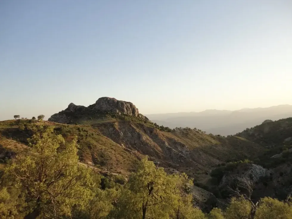
If you're looking for a fantastic travel destination full of natural wonders, look no further than the Zagros mountains.
The Zagros mountains originate from northwestern Iran, running through the western border areas of Iran, and offer everything from snow-capped peaks to lush green valleys. Apart from Iran, these mountains also cover a part of Northeastern Iraq and the Southeast of Turkey.
The Zagros mountain range spans the entire length of the southwestern and western Iranian plateau and eventually ends at the Strait of Hormuz. Interestingly, the Zagros fold, which gave rise to the Zagros mountains, was formed due to a collision between the Arabian Plate and the Eurasian plate.
The Zagros region is an integral part of oil located in the Persian Gulf as they run along its north coast.
According to scientists, the tectonic history of the Zagros mountain rocks played a pivotal role in trapping petroleum underground. Did you know, back in time, these mountains defined the borders between Persian and Ottoman empires and the Parthian and Roman empires?
Ecosystems And Wildlife
The Zagros range is primarily covered by pistachio, oak trees, steppe vegetation surrounding extensive grounds, and temperate broad-leaved forests when it comes to vegetation cover. Persian Oak is believed to be the most important one of all plant species in this ecosystem.
There are various kinds of ecosystems in the Zagros mountains, but the mountains primarily experience a semi-arid temperate climate. The high-level institutions have defined the ecosystem of the Zagros mountains as the 'Zagros Mountains forest steppe ecoregion.
The Zagros mountains experience a highly arid climate during the summer, but the winter season days are extremely cold, with substantial temperature drops.
The Zagros mountains receive the most rainfall during the early spring and winter seasons, with average rainfall between 16-31 in (40.64-78.74 cm). The Zagros mountains are also home to various plants and animals. Let's take a closer look at some flora and fauna native to these mountains in Iran.
Flora And Fauna
The Zagros Mountains of Iran are home to a wide variety of plants and animals, but in recent times the mountain range has suffered from deforestation and overgrazing.
As a result, protected areas such as The Mooteh Protected Area and Arjan Protected Area have been established to preserve the rapidly decreasing flora and fauna in the forests of the Zagros mountains.
Almost half of the forest of the Zagros mountains is covered by the Persian Oak species.
Many other plant species are only found in the Zagros mountains, including the likes of Tulipa kurdica, Iris barnumiae, and Allium iranicum. Moving on to the fauna of this mountain region, various kinds of mammals such as brown bears, wild goats, wolves, and leopards are spotted in significant numbers in this region.
Interestingly, these goats could easily survive on dry grass, which allowed Neolithic people back in the day to farm on the foothills of this mountain.
Did you know, during the 1800s, the Asiatic lion lived in the forest region of the Zagros mountains? It is now extinct and can no more be found?
Various kinds of birds like the black vultures and partridges also live in this region. You can also spot the golden eagle living at significant elevation in the Zagros mountains. Various endangered animal species such as Basra reed-warbler, Luristan newt, and the striped hyena live in this mountain region of Iran.

Type And Age Of Rock
The Zagros mountains are made up of limestone and sedimentary origin. Near the mountain top, one can find paleozoic rocks along the main fault of the Zagros mountains. At the same time, on both sides of the main fault, one can discover Mesozoic rocks.
Interestingly, the Eurasian plate and Arabian plate collision led to stress in the Earth's crust. When combined with erosion led to the removal of softer rocks such as siltstone and mudstone.
Interestingly, the linear ridges that one can spot at the Zagros mountains of Iran were formed due to differential erosion. Did you know the oldest rocks found in the Zagros mountains date back to the Precambrian period speaking leaps and bounds about the age of these mountain ranges in Iran?
Visiting The Zagros Mountains
Zagros mountains are one of the most commonly visited places by tourists traveling to Iran. These mountains run from the northern part of Iran to the southeast of Turkey.
People who visit these mountains are attracted by the fact that the mountains help in changing the climate of the nearby locations drastically. People can travel a few kilometers around these mountains and experience varying climates.
Tourists believed that the best way to visit the Zagros mountains is by reaching Shiraz city and then going for a two-hour drive from there to the mountain base. From here, you can now trek on the mountain and also experience river trekking in between the mountains.
At an elevation of 14,465 ft (4408.9 m), Mount Dena is the highest peak of the Zagros mountains, which often fascinates people traveling to these ranges.
Terrain In The Zagros Mountains
Irrespective of the ranges being called mountains, the region experiences a varied terrain due to the extensive folding of the tectonic plates in the past. Let's take a look at what kinds of terrain comprise the Zagros mountains.
Most of the area is covered by plateaus and lowlands, which are occasionally interrupted by the Shiraz range and the salt marshes, flatlands at times. At the same time, while visiting these mountains, you can come across a number of seasonal as well as traditional rivers which flow through these mountains.
These rivers generally flow into the Lake of Jaz Murian or the Gulf of Oman.


We Want Your Photos!
More for You


Sources
https://www.worldwildlife.org/ecoregions/pa0446
https://againstthecompass.com/en/zagros-mountains-iran/
https://kids.kiddle.co/Zagros_Mountains
https://www.worldatlas.com/amp/mountains/zagros-mountains.html
https://en.wikipedia.org/wiki/Zagros_Mountains
See All
Bachelor of Business Administration specializing in Marketing
Aryan KhannaBachelor of Business Administration specializing in Marketing
A dedicated and hardworking content writer currently pursuing his Bachelor's in Management Studies from St. Xavier's University, Kolkata. Aryan aims to gain corporate exposure and enhance his skills while creating well-researched and engaging content that is SEO-friendly. Aryan is a talented individual who puts in the effort to overcome any obstacle in his way.
Postgraduate Diploma in Management

Sakshi RaturiPostgraduate Diploma in Management
Sakshi has experience in marketing strategy, social media planning, and recruiting industry experts for capstone projects, she has displayed a commitment to enhancing their skills and knowledge. She has won multiple awards, including a Certificate of Appreciation for Creative Writing and a Certificate of Merit for Immaculate Turut, and is always seeking new opportunities to grow and develop.
Disclaimer
1) Kidadl is independent and to make our service free to you the reader we are supported by advertising. We hope you love our recommendations for products and services! What we suggest is selected independently by the Kidadl team. If you purchase using the Buy Now button we may earn a small commission. This does not influence our choices. Prices are correct and items are available at the time the article was published but we cannot guarantee that on the time of reading. Please note that Kidadl is a participant in the Amazon Services LLC Associates Program, an affiliate advertising program designed to provide a means for sites to earn advertising fees by advertising and linking to Amazon. We also link to other websites, but are not responsible for their content.
2) At Kidadl, we strive to recommend the very best activities and events. We will always aim to give you accurate information at the date of publication - however, information does change, so it’s important you do your own research, double-check and make the decision that is right for your family. We recognise that not all activities and ideas are appropriate for all children and families or in all circumstances. Our recommended activities are based on age but these are a guide. We recommend that these ideas are used as inspiration, that ideas are undertaken with appropriate adult supervision, and that each adult uses their own discretion and knowledge of their children to consider the safety and suitability. Kidadl cannot accept liability for the execution of these ideas, and parental supervision is advised at all times, as safety is paramount. Anyone using the information provided by Kidadl does so at their own risk and we can not accept liability if things go wrong.
3) Because we are an educational resource, we have quotes and facts about a range of historical and modern figures. We do not endorse the actions of or rhetoric of all the people included in these collections, but we think they are important for growing minds to learn about under the guidance of parents or guardians.