24 Curious Columbia Plateau Facts Revealed For Geography Buffs


Gallery
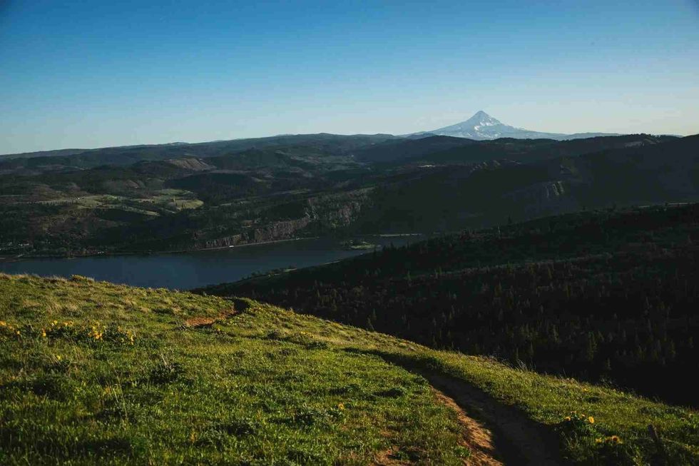
The Columbia Plateau is an important geographical area, as well as a geological region lying across the states of Washington, Idaho, and Oregon in the west of the US.
The Columbia Plateau is a flood basalt plateau region occurring between the Rocky Mountains and the Cascade Range. The Columbia River Basin goes through it.
The plateau has existed since the late Miocene and early Pliocene times. During this period, a flood of basalt engulfed this place along the sides of the Pacific Northwest.
This resulted in the creation of a large igneous province. Consequently, the lava flow finally cooled down and made an accumulation to a thickness of more than 6,000 ft (18288 m).
The Columbian River's basaltic lava flows have created seven formations, some of which are Steens Basalt, Grande Ronde Basalt, and Prineville Basalt. The ancient Columbia River has been forcibly made to flow over the area filled with different stream valleys. This has resulted in the formation of dams, which have been causing impoundments or lakes.
The Location Of The Columbia Plateau
There are many things to learn about the Columbia Plateau ecoregion and the Columbia River Basin! Read on to learn more:
- As we already know, the Columbia Plateau is stretched over three provinces of the United States in America. They are the western states of Washington, Idaho, and Oregon.
- In the state of Idaho, the Columbia Plateau Province encompasses an area in Central Idaho and Western Idaho.
- Interestingly, in the state of Idaho, a large part of the plateau is within the territories of Payette National Forest, the Camas Prairie, and the Clearwater National Forest.
- The plateau covers a different number of counties in Idaho that include Latah County, Kootenai County, Gem County, and Adams County, amongst others.
- The Snake River Basin also lies in Idaho in the southwestern parts of the state. However, the Snake River Basin is not a part of the Columbia Plateau.
- Did you know the Columbia Plateau is a flat land and was noted by travelers who crossed the Bitterroot Mountains as early as 1805?
- The northern border of the plateau is bordered by the Columbia River and the Okanagon River in the state of Washington.
- It was previously thought that the Canadian province of British Columbia was part of this plateau, containing the Columbia River Basin.
- Washington State is the northernmost border of the plateau. It is mainly located in eastern Washington, just west of the Rocky Mountains.
- The iconic Tri-Cities of Washington, namely Kennewick, Pasco, and Richland, are all part of the Columbia Basin or Plateau.
- The other cities that are located in the Washington-portion of the plateau include Moses Lake and Spokane.
- The state of Oregon has the most amount of territory designated to the Columbia Basin in its northeastern and central parts.
- Oregon also has several landforms, including the Deschutes River Basin.
Landforms Of The Columbia Plateau
A number of landforms are the characteristic feature of the Columbia Plateau, which was formed in the North American plate due to a volcanic fissure eruption about 6-16 million years ago. These landforms are discussed briefly below!
- Yakima Fold Belt: The southwestern section of the Columbia Plateau has a series of treeless ridges that extend in a west to east direction. This is known as the Yakima Fold Belt. Geologically speaking, the Yakima Fold Belt consists of folded rock layers. These folds are due to geological faults and tectonic stresses.
- Palouse Hills: Apart from steep valleys, the Palouse Hills are one of the most aesthetic landforms in the Columbia Plateau. The hills usually appear tapered and are loess in nature. Internally, the hills consist of alternate layers of calcrete and loess.
- Channeled Scablands: The distinct feature of the Columbia Plateau is the Channeled Scablands. The Ice Age Floods, also known as the Missoula Floods, resulted in the formation of this landform ages ago. The Channeled Scablands display a unique kind of drainage, which starts in the northeast and ends in the southwest.
- The Northern Blue Mountains: The Northern Blue Mountains, which covers an area of 15,000 sq mi (38850 sq km), is an iconic feature of the Columbia Plateau. These mountains received their name became from a distance they appeared blue. The Northern Blue Mountains are 9843 ft (3000 m) above sea level.

The Importance Of The Columbia Plateau
The Columbia Plateau, covering 100,000 sq mi (258,999 sq km), is quite an important site for a number of reasons. Hence, it is essential to read about them as well.
- A major portion of Oregon's grains is produced in the Columbia Plateau. The second-highest agricultural sales occur in the Columbia Plateau in Oregon. The mollisols composition of the Columbia Plateau makes the plateau highly fertile but also dry during summers.
- The Columbia River Basin, including the interior Columbia River Basin, where the Columbia Plateau is located, also acts as a major supplier of hydroelectric power. Over 40% of hydroelectric power is sourced from here.
- The lands of the Columbia Plateau provide enough space for agriculture and grazing.
Resources Of The Columbia Plateau
The resources that are recovered from Columbia Plateau are highly essential and valuable. Hence, this geographic region helps in strengthening the economy of the country.
- Gold is one of the main resources collected here, making mining a form of human interaction in the plateau. The Blue Mountains in the Columbia Plateau is a site where gold is mined.
- A large number of mineral resources that are used as building materials are found here. Some of these are stone, gravel, and sand. There are also quarries, which are significantly big in size.
- Other important minerals that are recovered from this region are silver, aguilarite, argentite, and naumannite.
- Zeolite, which is a kind of mineral, is used to change hard water to soft water. These zeolite deposits are found in the Columbia Plateau resulting from alkaline volcanic ejecta materials.


We Want Your Photos!
More for You


See All
Bachelor of Arts specializing in English Literature
Akinwalere OlaleyeBachelor of Arts specializing in English Literature
As a highly motivated, detail-oriented, and energetic individual, Olaleye's expertise lies in administrative and management operations. With extensive knowledge as an Editor and Communications Analyst, Olaleye excels in editing, writing, and media relations. Her commitment to upholding professional ethics and driving organizational growth sets her apart. She has a bachelor's degree in English Literature from the University of Benin, Edo State.
Disclaimer
1) Kidadl is independent and to make our service free to you the reader we are supported by advertising. We hope you love our recommendations for products and services! What we suggest is selected independently by the Kidadl team. If you purchase using the Buy Now button we may earn a small commission. This does not influence our choices. Prices are correct and items are available at the time the article was published but we cannot guarantee that on the time of reading. Please note that Kidadl is a participant in the Amazon Services LLC Associates Program, an affiliate advertising program designed to provide a means for sites to earn advertising fees by advertising and linking to Amazon. We also link to other websites, but are not responsible for their content.
2) At Kidadl, we strive to recommend the very best activities and events. We will always aim to give you accurate information at the date of publication - however, information does change, so it’s important you do your own research, double-check and make the decision that is right for your family. We recognise that not all activities and ideas are appropriate for all children and families or in all circumstances. Our recommended activities are based on age but these are a guide. We recommend that these ideas are used as inspiration, that ideas are undertaken with appropriate adult supervision, and that each adult uses their own discretion and knowledge of their children to consider the safety and suitability. Kidadl cannot accept liability for the execution of these ideas, and parental supervision is advised at all times, as safety is paramount. Anyone using the information provided by Kidadl does so at their own risk and we can not accept liability if things go wrong.
3) Because we are an educational resource, we have quotes and facts about a range of historical and modern figures. We do not endorse the actions of or rhetoric of all the people included in these collections, but we think they are important for growing minds to learn about under the guidance of parents or guardians.