Why Do Oceanic Plates Go Under Continental Plates?


Gallery
Earth's outer surface is made up of approximately 20 tectonic plates, which are massive sections of Earth's crust that fit together roughly and meet plate boundaries.
Plate boundaries are significant because earthquakes and volcanoes are frequently linked to them. When the tectonic plates of the Earth collide, enormous amounts of energy can be released as earthquakes.
Because magma, or molten rock, from deep under the Earth can move upward at these plate intersections, volcanoes are typically found close to plate boundaries. There are numerous types of plate boundaries.
For instance, portions of Earth's crust can slide past one another, come together and smash (convergent plate border), or spread apart (divergent plate boundary). Different geological features are connected to each of these types of plate boundaries.
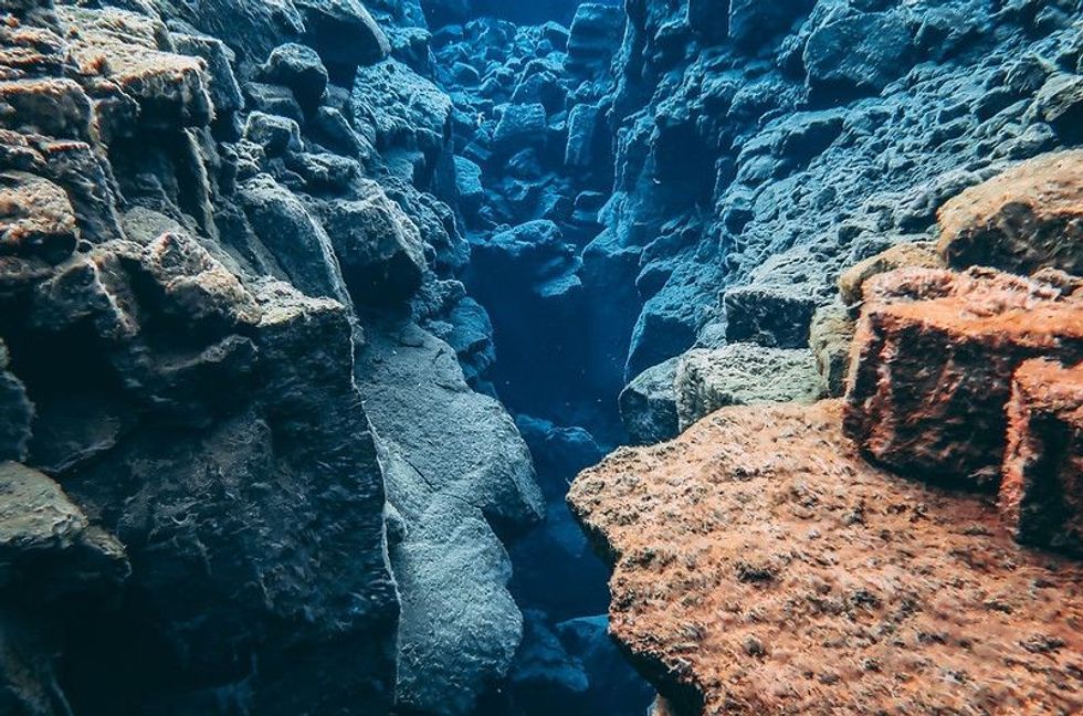
The denser oceanic plate sinks beneath the less dense plate when the oceanic and continental crust collides. In oceanic trenches, the process known as subduction takes place.
A volcano rises above the water's surface to form an island volcano after building up on the ocean floor for millions of years. Typically, these volcanoes are arranged in groups known as island arcs.
The Marianas and the Aleutian Islands are examples of island arcs, and the trenches hold the key to understanding how they formed and why they frequently experience powerful earthquakes.
The descending plate or the underlying oceanic lithosphere can partially melt to produce the magmas that form island arcs. As the two plates interact and frequently produce moderate to strong earthquakes, the descending plate serves as another source of stress.
What happens when oceanic and continental plates collide?
It is impossible for the rock that makes up continental plates to be pulled under the Earth and transformed into magma because it is typically lighter and less dense than oceanic rock. Instead, the rock at the boundary is crunched and folded by the collision of two continental plates, lifting it up and creating mountains and mountain ranges.
The Himalayan range in southern Asia is a prime example of this mountain-building process. The Himalayas, which span present-day Pakistan, India, Tibet, Bhutan, and Nepal, contain the highest mountain peak in the world.
They were formed when the Indian and Eurasian tectonic plates collided. India started to move northward toward Asia after Pangaea broke up, becoming an island continent. About 40–50 million years ago, the Himalayan mountain range was created when Asia and India's islands collided near Tibet.
Several of its highest peaks, including Mount Everest and K2, measure more than 26,000 ft (8,000 m) at their summits. The Himalayas continue to rise slightly each year due to the Indian Plate moving northward into Asia.
What are the different types of plate boundaries?
Scientists have a good idea of how plates move and how these movements relate to earthquake activity. The majority of movement occurs along narrow zones between plates, where plate-tectonic forces are most visible. There are three types of plate boundaries, namely divergent boundaries, convergent boundaries, and transform boundaries.
Divergent boundaries form along spreading centers as plates move and magma pushes up from the mantle to create a new crust.
A ridge is a mountain chain formed by a divergent plate boundary. This feature develops as magma diffuses into the space between the tectonic plates as they move apart.
The Mid-Atlantic Ridge is an example of a ridge formed by the separation of two pairs of tectonic plates, the Eurasian Plate and the North American Plate in the north and the African Plate and the South American Plate in the south.
When two continental plates diverge, the separation of land results in the formation of an ocean basin. On the other hand, a spreading center, referred to as a mid-ocean ridge, would develop if two oceanic plates diverged.
Shallow earthquakes are frequently related to divergent plate boundaries. Spreading processes in East Africa have already severed Saudi Arabia from the rest of the African continent, creating the Red Sea. When the cracks get too big, magma rises and pushes through them, sometimes erupting and causing volcanoes to form.
The Atlantic Ocean has grown from a narrow waterway bridging the continents of Europe, Africa, and the Americas to the enormous ocean it is now due to seafloor spreading over the past 100-200 million years.
The relatively light rocks that make up the continents resist downward motion like two colliding icebergs, so when two collide, neither is subducted. Instead, the crust buckles and moves up or to the side.
Scientists can examine firsthand how the Atlantic Ocean may have started to form about 200 million years ago thanks to plate interactions in the area.
A convergent boundary is created when two plates move toward one another. The Himalayan Mountains were created by the eventual collision of two continental crusted plates, which occurs when such plates converge.
Convergent boundaries are frequently linked to more significant earthquakes and increased volcanic activity. When a subduction zone forms, the subducted plate is partially melted by Earth's internal magma and becomes molten. This melting causes heat to be transferred upwards, raising the crust and eventually forming a volcano.
The Juan de Fuca plate is subducted beneath the North American Plate, creating the Cascade Mountains in northeastern California, including Lassen Peak, Mount Shasta, and Medicine Lake. For instance, the Philippine Plate and the swiftly moving Pacific Plate meet at the Mariana Trench, parallel to the Mariana Islands.
The Challenger Deep, at the southernmost tip of the Mariana Trench, reaches the planet's interior almost 36,000 ft (11,000 m) deep.
A magnitude 8.2 earthquake of 402 mi (647 km) in depth occurred on June 9, 1994, about 200 mi (322 km) northeast of La Paz, Bolivia. One of the largest and deepest subduction earthquakes ever recorded in South America, it occurred in the subduction zone between the South American Plate and the Nazca Plate.
By knowing the approximate duration of the reversal, scientists can calculate the average rate of plate movement over a given time period. This is done owing to the magnetic striping on the ocean floor, which records the flip-flops in the Earth's magnetic field.
It may be impossible for felsic magma at a continental arc to rise through the crust because it is too thick.
To create granite or granodiorite, the magma will gradually cool. These large intrusive igneous rock masses are called batholiths, which may one day be uplifted to create a mountain range.
A transform boundary also called a transform-fault boundary, is the area where two plates slide past one another horizontally. The San Andreas Fault, which causes numerous earthquakes in California, is a well-known example of a transform plate boundary.
Transform boundaries or faults are substantial faults or fracture zones that connect two spreading centers (divergent plate boundaries) or, less frequently, trenches (convergent plate boundaries).
The ocean floor is where you can find the majority of transform faults. They are typically defined by shallow earthquakes, which frequently offset the active spreading ridges to produce zigzag plate margins.
Some, like the San Andreas Fault zone in California, do, however, occur on land. Between the South Gorda-Juan de Fuca-Explorer Ridge and the East Pacific Rise, two divergent boundaries to the south and north, respectively, is this transform fault.
Oceanic fracture zones are valleys in the ocean floor that offset spreading ridges horizontally. Some of these zones have lengths of hundreds to thousands of miles.
Plate boundary zones are broad belts with ill-defined boundaries and unclear effects of plate interaction. They frequently have complex geological structures and earthquake patterns due to the presence of two large plates, and one or even more microplates sandwiched between them.
What is a subduction zone?
An oceanic plate may collide with a continental plate at certain convergent boundaries. Because oceanic crust is typically denser and thinner than continental crust, the denser oceanic crust is bent and pulled beneath the lighter and thicker continental crust or is subducted.
This creates a region called a subduction zone. Intense earthquakes and volcanic eruptions frequently occur in subduction zones. The mantle melts as a result of the subducting plate.
At the edge of the continent, a deep oceanic trench or valley forms as the oceanic crust sinks. As the crust is pushed deeper into the Earth, trapped water and other gases are released due to intense heat and pressure. This causes the crust's base to melt and create magma.
When a subduction zone forms magma, it rises toward the Earth's surface, gathers in magma chambers, and then feeds and erupts volcanoes on the overriding plate. The volcano erupts and spews lava and ash when this magma rises to the surface through a crack in the crust.
The Ring of Fire, a group of active volcanoes that encircles the Pacific Ocean, is one illustration of this.
As the two oceanic plates collide, a subduction zone is formed as the older plate is pushed under the younger one, resulting in forming an island arc, a chain of volcanic islands. Examples include the Aleutian Islands off the coast of Alaska and the Mariana Islands in the western Pacific Ocean.

Convergence Of Two Continental Plates
Oceanic sediments are compressed and upthrust between the two continental plates as they converge, and these compressed sediments manifest as fold mountains along the plate margins. An example of this kind of convergent plate boundary includes the Himalayan Mountains.
One of the most obvious and spectacular effects of plate tectonics is dramatically illustrated by the Himalayan mountain range. Due to the relatively light weight of the continental rocks, which act like two colliding icebergs, neither of the converging continents is subducted when they collide.
In contrast, the crust usually buckles and is pushed up or to the side.
50 million years ago, the Indian and Eurasian Plates collided with Asia, causing the collision zone to collapse.
The Himalayas and the Tibetan Plateau were raised to their present altitudes by the slow, continuous convergence of these two plates following the collision. The highest continental mountains in the world, the Himalayas, soar up to 29,032 ft (8,849 m) above sea level.
FAQs
Why do oceanic plates dive underneath continental plates when they collide?
Because of the density of the oceanic crust, the oceanic crust would always subduct beneath the continental crust during an oceanic-continental plate collision.
Why do continents ride on oceanic plates?
They float because they are resting on an upper mantle, also known as the asthenosphere, which is a layer of solid rock that is weak and ductile enough to flow very slowly under heat convection, resembling a liquid.
What happens when an oceanic plate collides with a continental plate?
When two oceanic plates or a plate carrying continents collide, one plate will bend and slide under the other. This process is called subduction.
What causes a plate to go under the other plate?
One tectonic plate may subduct beneath another due to a convergent plate boundary. This subduction process pushes an older, denser tectonic plate deep inside the Earth with the assistance of younger, thinner tectonic plates.


We Want Your Photos!
More for You


Sources
https://pubs.usgs.gov/gip/dynamic/understanding.html
https://divediscover.whoi.edu/plate-tectonics/plate-movements/
https://education.nationalgeographic.org/resource/plate-boundaries
https://www.coursehero.com/study-guides/geology/reading-theory-of-plate-tectonics/
https://geo.libretexts.org/Bookshelves/Oceanography/Book:_Oceanography_(Hill)/02:_Earth:_Formation_and_Structure/2.5:_Types_of_Plate_Boundaries
https://education.nationalgeographic.org/resource/plate-boundaries
https://geo.libretexts.org/Bookshelves/Oceanography/Book:_Oceanography_(Hill)/02:_Earth:_Formation_and_Structure/2.5:_Types_of_Plate_Boundaries#
https://www.wtamu.edu/~cbaird/sq/2013/07/18/what-keeps-the-continents-floating-on-a-sea-of-molten-rock/
https://www.learner.org/wp-content/interactive/dynamicearth/convergentboundaries/
See All
Master of Business Administration
Jaba SharmaMaster of Business Administration
A highly skilled content writer and editor, Jaba brings over six years of experience in the field to her role. She holds a Bachelor's degree in Science from Lucknow University and a Master's degree in Business Administration with a specialization in finance from the Institute of Environment & Management, Lucknow. Jaba's meticulous approach and creative mindset naturally led her into the world of content writing. She began her career as a Website Content Writer and Backend Admin at EventTraveler Pvt. Ltd, where she gained extensive experience in creating web pages, writing, and editing content and conducting in-depth web research.
Bachelor of Arts specializing in Political Science and Sociology

Spandana KantamBachelor of Arts specializing in Political Science and Sociology
Spandana holds a Bachelor's degree in Political Science from Acharya Nagarjuna University. She has a passion for writing and enjoys reading crime and thriller novels while listening to RnB music in her free time.
Disclaimer
1) Kidadl is independent and to make our service free to you the reader we are supported by advertising. We hope you love our recommendations for products and services! What we suggest is selected independently by the Kidadl team. If you purchase using the Buy Now button we may earn a small commission. This does not influence our choices. Prices are correct and items are available at the time the article was published but we cannot guarantee that on the time of reading. Please note that Kidadl is a participant in the Amazon Services LLC Associates Program, an affiliate advertising program designed to provide a means for sites to earn advertising fees by advertising and linking to Amazon. We also link to other websites, but are not responsible for their content.
2) At Kidadl, we strive to recommend the very best activities and events. We will always aim to give you accurate information at the date of publication - however, information does change, so it’s important you do your own research, double-check and make the decision that is right for your family. We recognise that not all activities and ideas are appropriate for all children and families or in all circumstances. Our recommended activities are based on age but these are a guide. We recommend that these ideas are used as inspiration, that ideas are undertaken with appropriate adult supervision, and that each adult uses their own discretion and knowledge of their children to consider the safety and suitability. Kidadl cannot accept liability for the execution of these ideas, and parental supervision is advised at all times, as safety is paramount. Anyone using the information provided by Kidadl does so at their own risk and we can not accept liability if things go wrong.
3) Because we are an educational resource, we have quotes and facts about a range of historical and modern figures. We do not endorse the actions of or rhetoric of all the people included in these collections, but we think they are important for growing minds to learn about under the guidance of parents or guardians.